


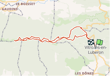
GR-Vitrolles en Luberon

JMCMoreau
User

Length
20 km

Max alt
1062 m

Uphill gradient
736 m
Km-Effort
30 km

Min alt
502 m

Downhill gradient
737 m
Boucle
Yes
Creation date :
2020-08-25 08:49:03.041
Updated on :
2020-08-25 08:51:38.265
7h30
Difficulty : Difficult

FREE GPS app for hiking
 SityTrail
IGN / Geographical institutes
SityTrail Plus
The world is yours!
About
Trail Walking of 20 km to be discovered at Provence-Alpes-Côte d'Azur, Vaucluse, Vitrolles-en-Luberon. This trail is proposed by JMCMoreau.
Positioning
Country:
France
Region :
Provence-Alpes-Côte d'Azur
Department/Province :
Vaucluse
Municipality :
Vitrolles-en-Luberon
Location:
Unknown
Start:(Dec)
Start:(UTM)
708723 ; 4854261 (31T) N.
Comments