


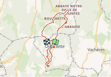
GR- Gorges d'Oppedette

JMCMoreau
User

Length
17.2 km

Max alt
627 m

Uphill gradient
511 m
Km-Effort
24 km

Min alt
414 m

Downhill gradient
510 m
Boucle
Yes
Creation date :
2020-08-25 14:43:07.355
Updated on :
2020-08-25 14:44:25.393
6h00
Difficulty : Medium

FREE GPS app for hiking
 SityTrail
IGN / Geographical institutes
SityTrail Plus
The world is yours!
About
Trail Walking of 17.2 km to be discovered at Provence-Alpes-Côte d'Azur, Alpes-de-Haute-Provence, Oppedette. This trail is proposed by JMCMoreau.
Positioning
Country:
France
Region :
Provence-Alpes-Côte d'Azur
Department/Province :
Alpes-de-Haute-Provence
Municipality :
Oppedette
Location:
Unknown
Start:(Dec)
Start:(UTM)
707723 ; 4867726 (31T) N.
Comments