


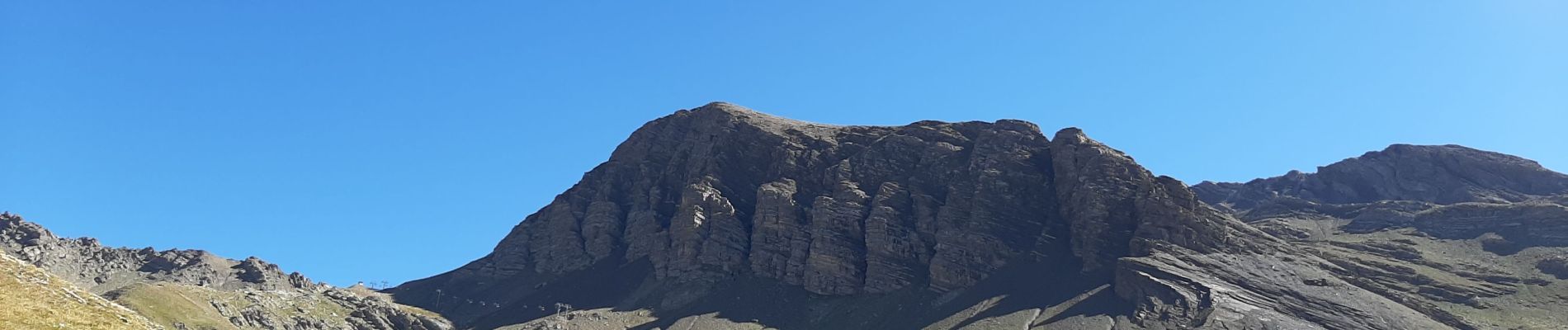
ORCIERRE les lacs .lac des EStaris , col de Freissinieres o

RobinMicheline
User GUIDE
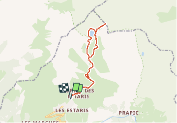

Length
14.6 km

Max alt
2782 m

Uphill gradient
952 m
Km-Effort
27 km

Min alt
1868 m

Downhill gradient
952 m
Boucle
Yes
Creation date :
2020-08-26 06:13:25.207
Updated on :
2020-08-26 13:53:19.58
4h55
Difficulty : Medium

FREE GPS app for hiking
 SityTrail
IGN / Geographical institutes
SityTrail Plus
The world is yours!
About
Trail Walking of 14.6 km to be discovered at Provence-Alpes-Côte d'Azur, Hautes-Alpes, Orcières. This trail is proposed by RobinMicheline.
Photos


26 photos in total. Please click on a photo to see them all in the gallery.
Positioning
Country:
France
Region :
Provence-Alpes-Côte d'Azur
Department/Province :
Hautes-Alpes
Municipality :
Orcières
Location:
Unknown
Start:(Dec)
Start:(UTM)
288405 ; 4953102 (32T) N.
Comments