


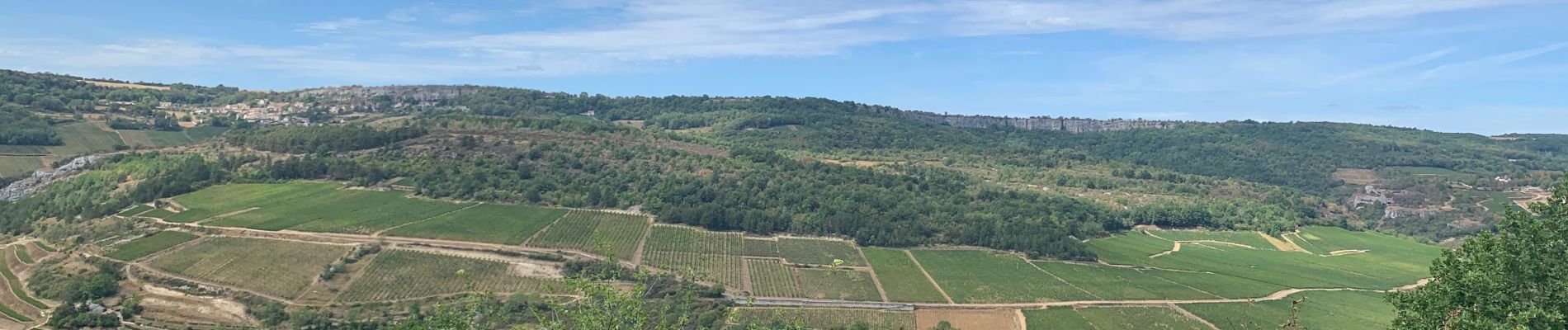
Camp des Celtes et sentier des Cabottes

francoisecarlier
User
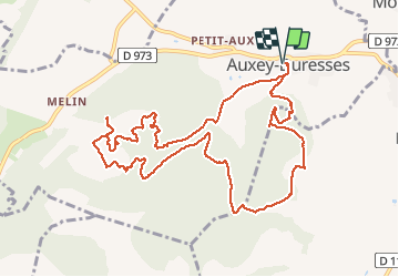

Length
12.5 km

Max alt
438 m

Uphill gradient
319 m
Km-Effort
16.7 km

Min alt
256 m

Downhill gradient
319 m
Boucle
Yes
Creation date :
2020-08-26 09:18:56.0
Updated on :
2020-08-26 13:59:19.82
4h09
Difficulty : Medium

FREE GPS app for hiking
 SityTrail
IGN / Geographical institutes
SityTrail Plus
The world is yours!
About
Trail Walking of 12.5 km to be discovered at Bourgogne-Franche-Comté, Côte-d'Or, Auxey-Duresses. This trail is proposed by francoisecarlier.
Photos


Positioning
Country:
France
Region :
Bourgogne-Franche-Comté
Department/Province :
Côte-d'Or
Municipality :
Auxey-Duresses
Location:
Unknown
Start:(Dec)
Start:(UTM)
632770 ; 5205110 (31T) N.
Comments