


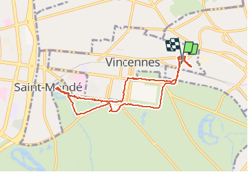
2020 08 26 Vincennes

Bocquenet
User

Length
8.8 km

Max alt
61 m

Uphill gradient
63 m
Km-Effort
9.6 km

Min alt
44 m

Downhill gradient
62 m
Boucle
Yes
Creation date :
2020-08-26 13:16:44.692
Updated on :
2020-08-26 17:29:52.403
2h42
Difficulty : Very easy

FREE GPS app for hiking
 SityTrail
IGN / Geographical institutes
SityTrail Plus
The world is yours!
About
Trail Walking of 8.8 km to be discovered at Ile-de-France, Val-de-Marne, Vincennes. This trail is proposed by Bocquenet.
Positioning
Country:
France
Region :
Ile-de-France
Department/Province :
Val-de-Marne
Municipality :
Vincennes
Location:
Unknown
Start:(Dec)
Start:(UTM)
459793 ; 5410608 (31U) N.
Comments