


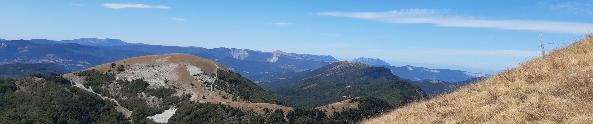
le pilhon la blanche.mont chauvet

Joel26400
User

Length
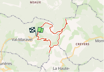
14.5 km

Max alt
1689 m

Uphill gradient
916 m
Km-Effort
27 km

Min alt
1083 m

Downhill gradient
915 m
Boucle
Yes
Creation date :
2020-08-27 06:11:41.274
Updated on :
2020-08-27 13:26:53.7
7h06
Difficulty : Medium

FREE GPS app for hiking
 SityTrail
IGN / Geographical institutes
SityTrail Plus
The world is yours!
About
Trail Walking of 14.5 km to be discovered at Auvergne-Rhône-Alpes, Drôme, Val-Maravel. This trail is proposed by Joel26400.
Description
tout en crêtes. hautes Alpes d'un côté. Drôme de l'autre.
Photos


Positioning
Country:
France
Region :
Auvergne-Rhône-Alpes
Department/Province :
Drôme
Municipality :
Val-Maravel
Location:
Unknown
Start:(Dec)
Start:(UTM)
706417 ; 4941082 (31T) N.
Comments