Trail Road bike Aurillac - col de Legal - Photo
© OpenStreetMap contributors
Length
Length
81 km
Max alt
Max alt
1235 m
Uphill gradient
Uphill gradient
1735 m
Km-Effort
Km-Effort  
104 km
Min alt
Min alt
612 m
Downhill gradient
Downhill gradient
1731 m
Boucle
Boucle
Yes
Creation date :
2020-08-27 07:39:43.96
Updated on :
2020-08-27 19:40:22.12

(0 Reviews)

Road bike
Road bike
4h28
Difficulty : Difficult

Scan this QR Code to open this trail in the SityTrail application

FREE GPS app for hiking

Logo SityTrail SityTrail

IGN / Geographical institutes

Download SityTrail from the App Store Download SityTrail from Google Play

Logo SityTrail SityTrail World

The world is yours!

Download SityTrail from the App Store Download SityTrail from Google Play Download SityTrail on Huawei AppGallery

About

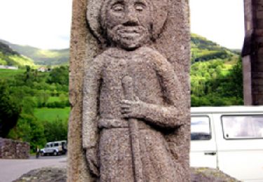
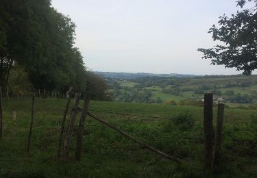
Trail Road bike of 81 km to be discovered at Auvergne-Rhône-Alpes, Cantal, Aurillac. This trail is proposed by Jean-Marie Bousquet.

Description

Aurillac- le Légal- col St Georges-St Chamand-St Projet de Salers -Tournemire-Fonbulin-Aurillac

Elevation profile

Positioning

Country:
France
Region :
Auvergne-Rhône-Alpes
Department/Province :
Cantal
Municipality :
Aurillac
Location:
Unknown
Start:(UTM)
455841 ; 4975965 (31T) N.

Trails nearby

Trail On foot Arpajon-sur-Cère - Puy de Vaurs - Photo
On foot
PRO

On foot

Easy
Arpajon-sur-Cère, Auvergne-Rhône-Alpes, Cantal, France
8 km | 11.7 km-effort
2h 40min
No
Trail Walking Reilhac - Don du sang Reilhac - Photo
Walking
alexecolo15

Walking

Very easy
(1)
Reilhac, Auvergne-Rhône-Alpes, Cantal, France
6.7 km | 9.1 km-effort
1h 19min
Yes
Trail Walking Aurillac - Aurillac Cueille Saint Jean de Done - Photo
Walking
alainlissac

Walking

Medium
(1)
Aurillac, Auvergne-Rhône-Alpes, Cantal, France
20 km | 27 km-effort
6h 22min
No
Trail Mountain bike Naucelles - VTT au départ de Naucelles - Photo
Mountain bike
tracegps

Mountain bike

Difficult
(2)
Naucelles, Auvergne-Rhône-Alpes, Cantal, France
41 km | 54 km-effort
4h 30min
Yes
Trail Running Aurillac - Marathon de Berganty 2012 - Aurillac - Photo
Running
tracegps

Running

Very difficult
Aurillac, Auvergne-Rhône-Alpes, Cantal, France
46 km | 69 km-effort
5h 30min
Yes
Trail Running Aurillac - Au départ d'Aurillac - Photo
Running
tracegps

Running

Medium
(1)
Aurillac, Auvergne-Rhône-Alpes, Cantal, France
15.9 km | 18.6 km-effort
1h 30min
Yes
Trail Walking Aurillac - Au départ d'Aurillac - Photo
Walking
tracegps

Walking

Difficult
Aurillac, Auvergne-Rhône-Alpes, Cantal, France
15.9 km | 18.6 km-effort
4h 0min
Yes
Trail Walking Aurillac - La Via Arverna (Aurillac -  Laroquebrou)  - Photo
Walking
tracegps

Walking

Difficult
Aurillac, Auvergne-Rhône-Alpes, Cantal, France
35 km | 42 km-effort
9h 15min
No
Trail Mountain bike Aurillac - Aurillac- st jean de done-Naucelle - Photo
Mountain bike
millot15

Mountain bike

Easy
Aurillac, Auvergne-Rhône-Alpes, Cantal, France
18.8 km | 25 km-effort
1h 56min
Yes


Close
My subscriptions