


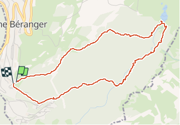
Lac Achard boucle Roche Bé-Arselle

GOHIER
User

Length
6 km

Max alt
1948 m

Uphill gradient
235 m
Km-Effort
9.1 km

Min alt
1717 m

Downhill gradient
242 m
Boucle
Yes
Creation date :
2020-08-30 11:20:32.0
Updated on :
2020-08-30 14:04:49.952
2h45
Difficulty : Unknown

FREE GPS app for hiking
 SityTrail
IGN / Geographical institutes
SityTrail Plus
The world is yours!
About
Trail Walking of 6 km to be discovered at Auvergne-Rhône-Alpes, Isère, Chamrousse. This trail is proposed by GOHIER.
Description
Humide mais seuls!😀
Positioning
Country:
France
Region :
Auvergne-Rhône-Alpes
Department/Province :
Isère
Municipality :
Chamrousse
Location:
Unknown
Start:(Dec)
Start:(UTM)
726268 ; 4998723 (31T) N.
Comments