


le Joug de l'aigle

orsel
User GUIDE
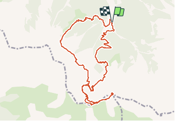

Length
13.6 km

Max alt
2450 m

Uphill gradient
959 m
Km-Effort
26 km

Min alt
1624 m

Downhill gradient
959 m
Boucle
Yes
Creation date :
2020-08-31 06:10:45.276
Updated on :
2020-08-31 16:37:27.297
6h57
Difficulty : Medium

FREE GPS app for hiking
 SityTrail
IGN / Geographical institutes
SityTrail Plus
The world is yours!
About
Trail Walking of 13.6 km to be discovered at Provence-Alpes-Côte d'Azur, Hautes-Alpes, Crots. This trail is proposed by orsel.
Description
avec Claire et Lucien
Positioning
Country:
France
Region :
Provence-Alpes-Côte d'Azur
Department/Province :
Hautes-Alpes
Municipality :
Crots
Location:
Unknown
Start:(Dec)
Start:(UTM)
299696 ; 4927412 (32T) N.
Comments