


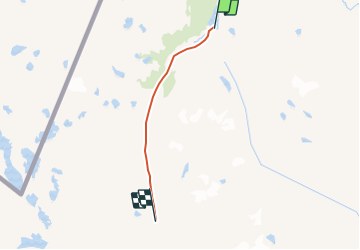
Kungsleden 3 alesjaur-salkastugorna

fpitance
User

Length
25 km

Max alt
1144 m

Uphill gradient
462 m
Km-Effort
31 km

Min alt
771 m

Downhill gradient
395 m
Boucle
No
Creation date :
2014-12-10 00:00:00.0
Updated on :
2014-12-10 00:00:00.0
6h40
Difficulty : Unknown

FREE GPS app for hiking
 SityTrail
IGN / Geographical institutes
SityTrail Plus
The world is yours!
About
Trail Other activity of 25 km to be discovered at Norrbotten County. This trail is proposed by fpitance.
Description
Etape la plus difficile, col de tjaktya. Possibilité d'étape intermédiaire


Positioning
Country:
Sweden
Region :
Norrbotten County
Department/Province :
Unknown
Municipality :
Unknown
Location:
Unknown
Start:(Dec)
Start:(UTM)
393363 ; 7560734 (34W) N.
Comments