Trail Walking Blot-l'Église - Le barrage de la Sep  - Photo
 Gegetop
Gegetop

User

© OpenStreetMap contributors
Length
Length
13.6 km
Max alt
Max alt
628 m
Uphill gradient
Uphill gradient
309 m
Km-Effort
Km-Effort  
17.7 km
Min alt
Min alt
490 m
Downhill gradient
Downhill gradient
306 m
Boucle
Boucle
Yes
Creation date :
2020-09-02 09:05:33.945
Updated on :
2020-09-02 16:54:35.057

(0 Reviews)

Walking
Walking
3h40
Difficulty : Very easy
Nordic walking
Nordic walking
3h21
Difficulty : Easy

Scan this QR Code to open this trail in the SityTrail application

FREE GPS app for hiking

Logo SityTrail SityTrail

IGN / Geographical institutes

Download SityTrail from the App Store Download SityTrail from Google Play

Logo SityTrail SityTrail World

The world is yours!

Download SityTrail from the App Store Download SityTrail from Google Play Download SityTrail on Huawei AppGallery

About

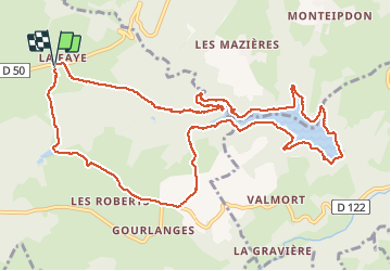
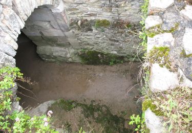
Trail Walking of 13.6 km to be discovered at Auvergne-Rhône-Alpes, Puy-de-Dôme, Blot-l'Église. This trail is proposed by Gegetop.

Description

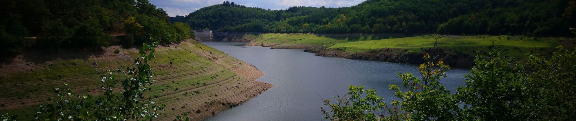
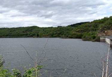
Très agréable de faire le tour du lac.

Elevation profile

Photos

Positioning

Country:
France
Region :
Auvergne-Rhône-Alpes
Department/Province :
Puy-de-Dôme
Municipality :
Blot-l'Église
Location:
Unknown
Start:(UTM)
498337 ; 5098429 (31T) N.

Trails nearby

Trail Walking Blot-l'Église - Blot_Eglise_Pery - Photo
Walking
GUIDE
jagarnier

Walking

Easy
(1)
Blot-l'Église, Auvergne-Rhône-Alpes, Puy-de-Dôme, France
9.8 km | 12.1 km-effort
3h 0min
Yes
Trail Walking Saint-Hilaire-la-Croix - Entre Sep et Morges - Photo
Walking
Gegetop

Walking

Medium
(1)
Saint-Hilaire-la-Croix, Auvergne-Rhône-Alpes, Puy-de-Dôme, France
14.6 km | 19.7 km-effort
3h 40min
Yes
Trail Walking Charbonnières-les-Vieilles - Les moulins de la Morge - Photo
Walking
tracegps

Walking

Medium
(1)
Charbonnières-les-Vieilles, Auvergne-Rhône-Alpes, Puy-de-Dôme, France
14.5 km | 19.4 km-effort
3h 49min
Yes
Trail On foot Blot-l'Église - Chapelle Saint-Valentin - Photo
On foot
PRO

On foot

Easy
Blot-l'Église, Auvergne-Rhône-Alpes, Puy-de-Dôme, France
13.6 km | 19.6 km-effort
4h 26min
Yes
Trail On foot Lisseuil - Lisseuil - Photo
On foot
PRO

On foot

Medium
Lisseuil, Auvergne-Rhône-Alpes, Puy-de-Dôme, France
14.4 km | 20 km-effort
4h 37min
Yes
Trail On foot Saint-Rémy-de-Blot - Chateau-Rocher - Photo
On foot
PRO

On foot

Easy
Saint-Rémy-de-Blot, Auvergne-Rhône-Alpes, Puy-de-Dôme, France
4.7 km | 6.9 km-effort
1h 34min
Yes
Trail Mountain bike Saint-Angel - St-Angel_Sioule_35 - Photo
Mountain bike
auvtopo

Mountain bike

Difficult
(1)
Saint-Angel, Auvergne-Rhône-Alpes, Puy-de-Dôme, France
35 km | 49 km-effort
3h 23min
Yes
Trail Walking Saint-Hilaire-la-Croix - St_Hilaire_Sep_Morge - Photo
Walking
GUIDE
jagarnier

Walking

Medium
Saint-Hilaire-la-Croix, Auvergne-Rhône-Alpes, Puy-de-Dôme, France
13.9 km | 19 km-effort
4h 15min
Yes
Trail On foot Saint-Hilaire-la-Croix - Entre Sep et la Morge - Photo
On foot
PRO

On foot

Easy
Saint-Hilaire-la-Croix, Auvergne-Rhône-Alpes, Puy-de-Dôme, France
14 km | 19.1 km-effort
4h 20min
Yes


Close
My subscriptions