


BELBRIETTE

surceneux
User
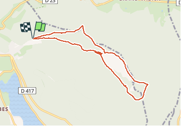

Length
8.4 km

Max alt
925 m

Uphill gradient
228 m
Km-Effort
11.5 km

Min alt
812 m

Downhill gradient
234 m
Boucle
Yes
Creation date :
2020-09-02 14:08:30.154
Updated on :
2020-09-02 21:36:23.189
2h10
Difficulty : Easy

FREE GPS app for hiking
 SityTrail
IGN / Geographical institutes
SityTrail Plus
The world is yours!
About
Trail Walking of 8.4 km to be discovered at Grand Est, Vosges, Xonrupt-Longemer. This trail is proposed by surceneux.
Description
BELBRIETTE TOUR PAR VALLON ET DETOURS..
Positioning
Country:
France
Region :
Grand Est
Department/Province :
Vosges
Municipality :
Xonrupt-Longemer
Location:
Unknown
Start:(Dec)
Start:(UTM)
347706 ; 5327989 (32U) N.
Comments