


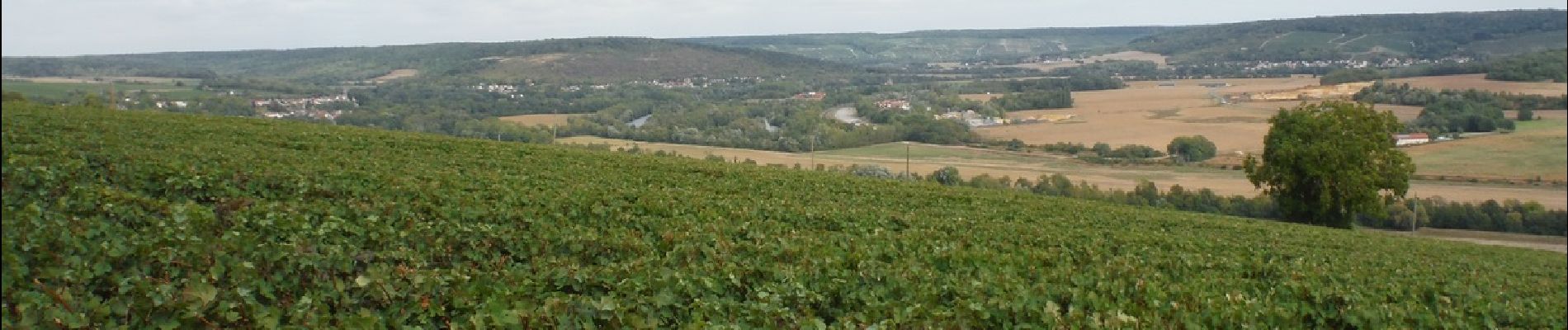
Château Thierry par Brasles du 03/09/2020

VANDERPUTTENMi
User GUIDE
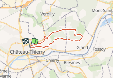

Length
11.3 km

Max alt
221 m

Uphill gradient
262 m
Km-Effort
14.8 km

Min alt
63 m

Downhill gradient
264 m
Boucle
Yes
Creation date :
2020-09-03 11:40:45.086
Updated on :
2020-09-06 09:19:14.738
3h06
Difficulty : Very easy

FREE GPS app for hiking
 SityTrail
IGN / Geographical institutes
SityTrail Plus
The world is yours!
About
Trail Walking of 11.3 km to be discovered at Hauts-de-France, Aisne, Château-Thierry. This trail is proposed by VANDERPUTTENMi.
Photos


Positioning
Country:
France
Region :
Hauts-de-France
Department/Province :
Aisne
Municipality :
Château-Thierry
Location:
Unknown
Start:(Dec)
Start:(UTM)
529685 ; 5432903 (31U) N.
Comments