


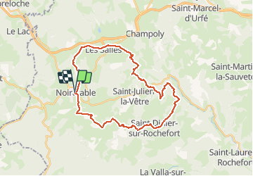
autour de noiretable

aml63
User

Length
32 km

Max alt
852 m

Uphill gradient
859 m
Km-Effort
43 km

Min alt
581 m

Downhill gradient
858 m
Boucle
Yes
Creation date :
2020-09-05 12:22:38.323
Updated on :
2020-09-05 12:24:00.708
2h47
Difficulty : Difficult

FREE GPS app for hiking
 SityTrail
IGN / Geographical institutes
SityTrail Plus
The world is yours!
About
Trail Mountain bike of 32 km to be discovered at Auvergne-Rhône-Alpes, Loire, Noirétable. This trail is proposed by aml63.
Description
st didier st julien les salles
Positioning
Country:
France
Region :
Auvergne-Rhône-Alpes
Department/Province :
Loire
Municipality :
Noirétable
Location:
Unknown
Start:(Dec)
Start:(UTM)
559448 ; 5074008 (31T) N.
Comments