


Giromagny - sentier des mines - 2 à visiter

Bart2015
User
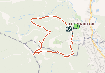

Length
4.3 km

Max alt
721 m

Uphill gradient
166 m
Km-Effort
6.5 km

Min alt
544 m

Downhill gradient
173 m
Boucle
Yes
Creation date :
2020-09-05 12:41:46.202
Updated on :
2020-09-07 07:25:21.552
1h15
Difficulty : Easy

FREE GPS app for hiking
 SityTrail
IGN / Geographical institutes
SityTrail Plus
The world is yours!
About
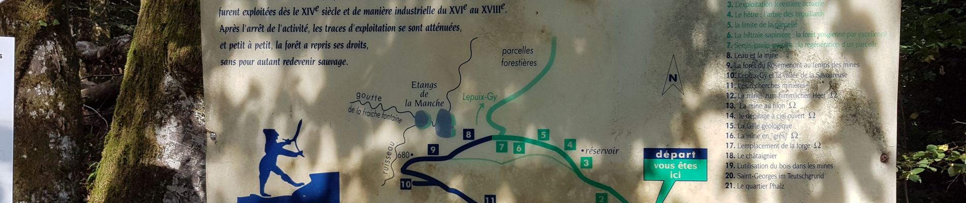
Trail Walking of 4.3 km to be discovered at Bourgogne-Franche-Comté, Territoire-de-Belfort, Lepuix. This trail is proposed by Bart2015.
Photos


Positioning
Country:
France
Region :
Bourgogne-Franche-Comté
Department/Province :
Territoire-de-Belfort
Municipality :
Lepuix
Location:
Unknown
Start:(Dec)
Start:(UTM)
336147 ; 5290987 (32T) N.
Comments