Canal aiguevive

JPDL31
User

Length
7.1 km

Max alt
174 m

Uphill gradient
69 m
Km-Effort
8 km

Min alt
157 m

Downhill gradient
70 m
Boucle
Yes
Creation date :
2020-09-06 09:29:36.0
Updated on :
2020-09-06 11:25:03.21
1h55
Difficulty : Unknown

FREE GPS app for hiking
 SityTrail
IGN / Geographical institutes
SityTrail Plus
The world is yours!
About
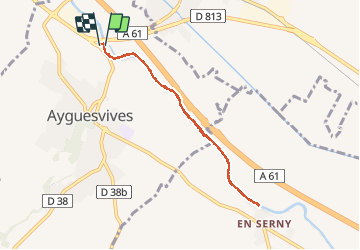
Trail Walking of 7.1 km to be discovered at Occitania, Haute-Garonne, Ayguesvives. This trail is proposed by JPDL31.
Positioning
Country:
France
Region :
Occitania
Department/Province :
Haute-Garonne
Municipality :
Ayguesvives
Location:
Unknown
Start:(Dec)
Start:(UTM)
386688 ; 4811406 (31T) N.
Comments