


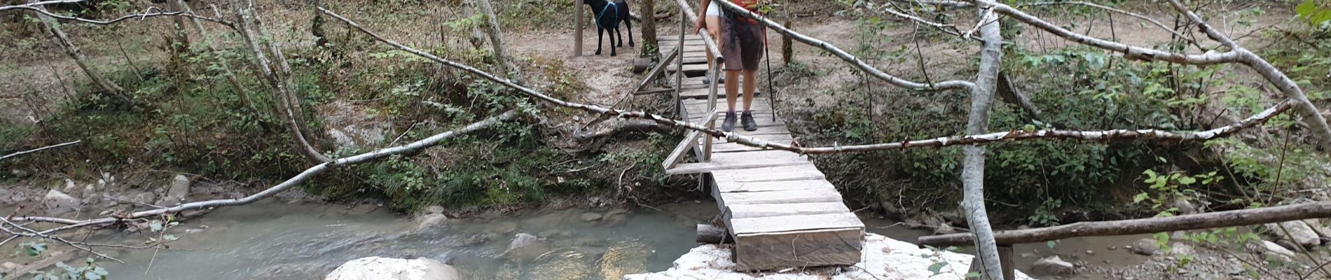
gorges de Trévans 6 septembre 2020

harydh
User GUIDE
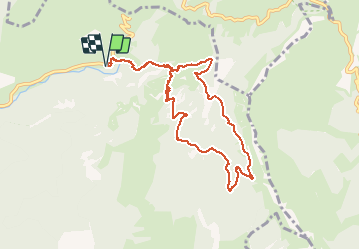

Length
9.4 km

Max alt
900 m

Uphill gradient
406 m
Km-Effort
14.9 km

Min alt
600 m

Downhill gradient
405 m
Boucle
Yes
Creation date :
2020-09-06 09:09:15.817
Updated on :
2020-09-07 07:10:59.655
3h23
Difficulty : Easy

FREE GPS app for hiking
 SityTrail
IGN / Geographical institutes
SityTrail Plus
The world is yours!
About
Trail Walking of 9.4 km to be discovered at Provence-Alpes-Côte d'Azur, Alpes-de-Haute-Provence, Estoublon. This trail is proposed by harydh.
Photos


Positioning
Country:
France
Region :
Provence-Alpes-Côte d'Azur
Department/Province :
Alpes-de-Haute-Provence
Municipality :
Estoublon
Location:
Unknown
Start:(Dec)
Start:(UTM)
276988 ; 4869782 (32T) N.
Comments