


z l'île ste marguerite 08-09-20

cb8310
User
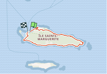

Length
7.4 km

Max alt
38 m

Uphill gradient
95 m
Km-Effort
8.6 km

Min alt
0 m

Downhill gradient
94 m
Boucle
Yes
Creation date :
2020-09-08 08:24:36.626
Updated on :
2020-09-12 06:09:04.6
2h01
Difficulty : Very easy

FREE GPS app for hiking
 SityTrail
IGN / Geographical institutes
SityTrail Plus
The world is yours!
About
Trail Walking of 7.4 km to be discovered at Provence-Alpes-Côte d'Azur, Maritime Alps, Cannes. This trail is proposed by cb8310.
Description
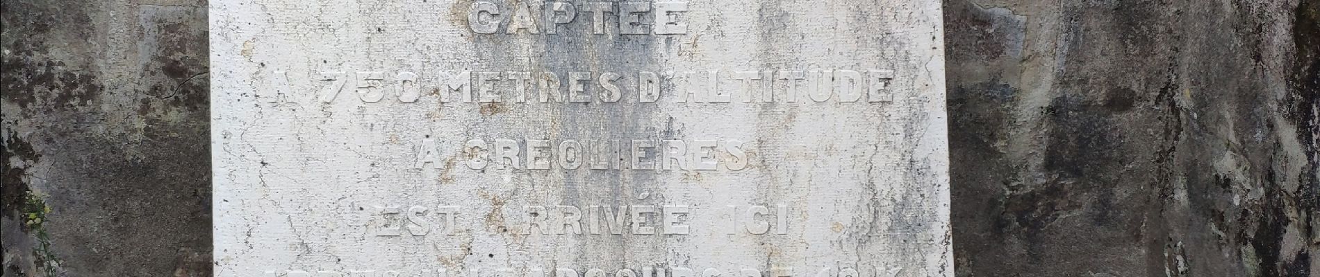
rando superbe dans les sous-bois de l'île ,sans aucune difficulté
Photos


Positioning
Country:
France
Region :
Provence-Alpes-Côte d'Azur
Department/Province :
Maritime Alps
Municipality :
Cannes
Location:
Unknown
Start:(Dec)
Start:(UTM)
341511 ; 4820645 (32T) N.
Comments