


06.03.2014 - Martigné...

babeth35
User
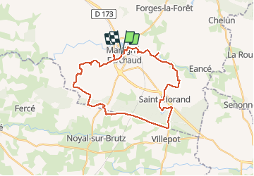

Length
30 km

Max alt
130 m

Uphill gradient
274 m
Km-Effort
34 km

Min alt
61 m

Downhill gradient
274 m
Boucle
Yes
Creation date :
2014-12-10 00:00:00.0
Updated on :
2020-07-20 16:09:42.857
8h00
Difficulty : Easy

FREE GPS app for hiking
 SityTrail
IGN / Geographical institutes
SityTrail Plus
The world is yours!
About
Trail Walking of 30 km to be discovered at Brittany, Ille-et-Vilaine, Martigné-Ferchaud. This trail is proposed by babeth35.
Photos

Positioning
Country:
France
Region :
Brittany
Department/Province :
Ille-et-Vilaine
Municipality :
Martigné-Ferchaud
Location:
Unknown
Start:(Dec)
Start:(UTM)
625678 ; 5298926 (30T) N.
Comments