


La Dent de Crolles en boucle

choubaka77
User
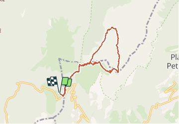

Length
7.9 km

Max alt
2038 m

Uphill gradient
692 m
Km-Effort
17.2 km

Min alt
1432 m

Downhill gradient
694 m
Boucle
Yes
Creation date :
2020-09-13 07:36:32.0
Updated on :
2020-09-14 06:35:33.578
4h02
Difficulty : Difficult

FREE GPS app for hiking
 SityTrail
IGN / Geographical institutes
SityTrail Plus
The world is yours!
About
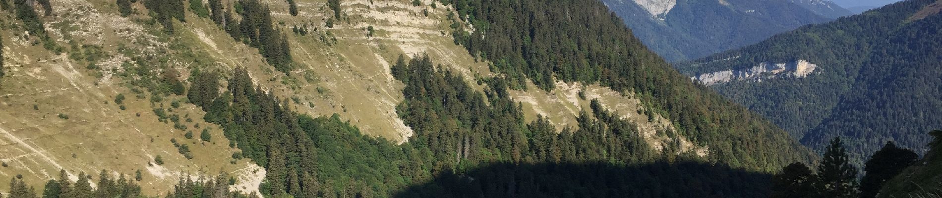
Trail Walking of 7.9 km to be discovered at Auvergne-Rhône-Alpes, Isère, Saint-Pierre-de-Chartreuse. This trail is proposed by choubaka77.
Description
Très belle boucle mais attention par temps humide !!!
Prévoir bâtons et chaussures avec de bons crampons et du gripp !!!
Photos


Positioning
Country:
France
Region :
Auvergne-Rhône-Alpes
Department/Province :
Isère
Municipality :
Saint-Pierre-de-Chartreuse
Location:
Unknown
Start:(Dec)
Start:(UTM)
722285 ; 5020555 (31T) N.
Comments