


les raperins à l'alpage d'Arpille

JLBragard
User

Length
4.3 km

Max alt
1892 m

Uphill gradient
701 m
Km-Effort
11.3 km

Min alt
1186 m

Downhill gradient
1 m
Boucle
No
Creation date :
2020-09-14 08:05:24.226
Updated on :
2020-09-14 13:30:51.07
1h27
Difficulty : Difficult

FREE GPS app for hiking
 SityTrail
IGN / Geographical institutes
SityTrail Plus
The world is yours!
About
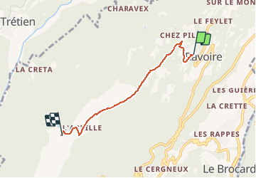
Trail Walking of 4.3 km to be discovered at Valais/Wallis, Martigny, Martigny-Combe. This trail is proposed by JLBragard.
Description
montée vaes le mont Arpille
Positioning
Country:
Switzerland
Region :
Valais/Wallis
Department/Province :
Martigny
Municipality :
Martigny-Combe
Location:
Unknown
Start:(Dec)
Start:(UTM)
348697 ; 5106589 (32T) N.
Comments