


Valvigniere Galére !

JeanPierreNancy
User
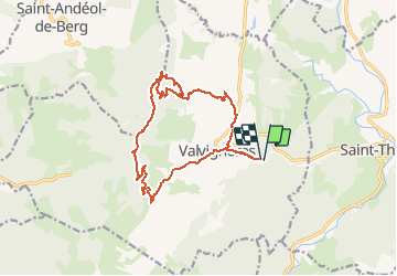

Length
18 km

Max alt
487 m

Uphill gradient
523 m
Km-Effort
25 km

Min alt
152 m

Downhill gradient
521 m
Boucle
Yes
Creation date :
2020-09-18 07:24:41.371
Updated on :
2020-09-18 09:43:30.495
2h18
Difficulty : Difficult

FREE GPS app for hiking
 SityTrail
IGN / Geographical institutes
SityTrail Plus
The world is yours!
About
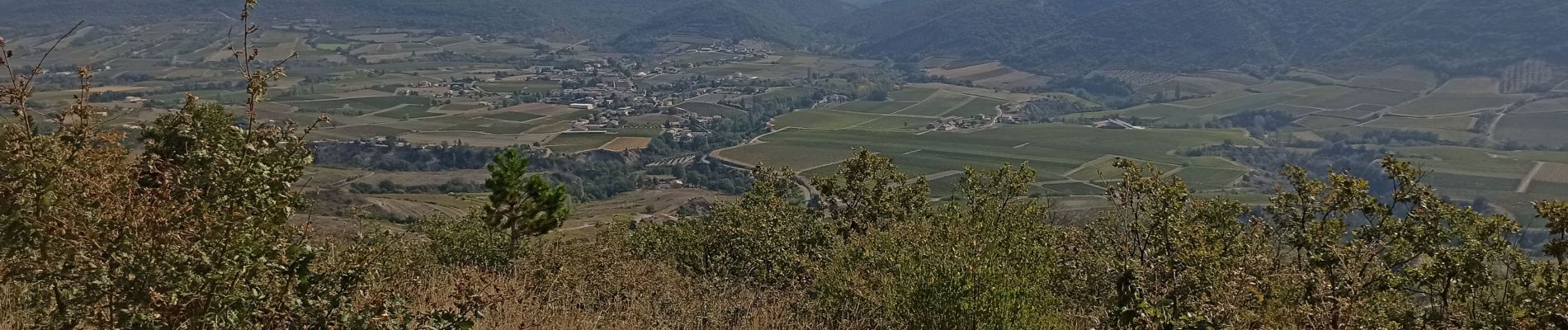
Trail Mountain bike of 18 km to be discovered at Auvergne-Rhône-Alpes, Ardèche, Valvignères. This trail is proposed by JeanPierreNancy.
Description
beaucoup de portage et de poussage, donc demi tour !
Photos

Positioning
Country:
France
Region :
Auvergne-Rhône-Alpes
Department/Province :
Ardèche
Municipality :
Valvignères
Location:
Unknown
Start:(Dec)
Start:(UTM)
626324 ; 4928425 (31T) N.
Comments