


trace pic de morgon

TOULAUDIN
User
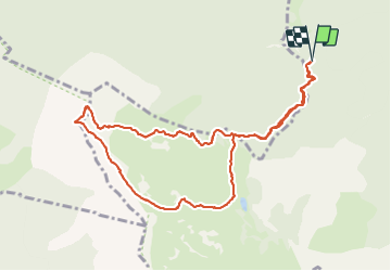

Length
11 km

Max alt
2311 m

Uphill gradient
724 m
Km-Effort
21 km

Min alt
1670 m

Downhill gradient
723 m
Boucle
Yes
Creation date :
2020-09-18 07:59:48.484
Updated on :
2021-11-16 12:42:38.192
5h48
Difficulty : Difficult

FREE GPS app for hiking
 SityTrail
IGN / Geographical institutes
SityTrail Plus
The world is yours!
About
Trail Walking of 11 km to be discovered at Provence-Alpes-Côte d'Azur, Hautes-Alpes, Crots. This trail is proposed by TOULAUDIN.
Description
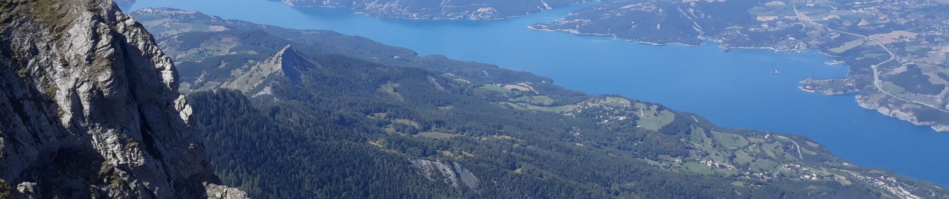
rando difficile, mais vue sublime sur le lac de Serre Ponçon
Photos


Positioning
Country:
France
Region :
Provence-Alpes-Côte d'Azur
Department/Province :
Hautes-Alpes
Municipality :
Crots
Location:
Unknown
Start:(Dec)
Start:(UTM)
296026 ; 4930472 (32T) N.
Comments