


Hasselfurth BS

bstebe
User
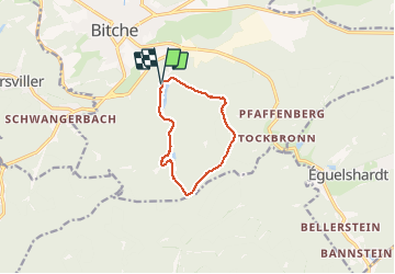

Length
8.3 km

Max alt
428 m

Uphill gradient
173 m
Km-Effort
10.6 km

Min alt
294 m

Downhill gradient
174 m
Boucle
Yes
Creation date :
2020-09-18 12:26:11.152
Updated on :
2020-09-18 15:03:17.519
2h14
Difficulty : Very easy

FREE GPS app for hiking
 SityTrail
IGN / Geographical institutes
SityTrail Plus
The world is yours!
About
Trail Walking of 8.3 km to be discovered at Grand Est, Moselle, Bitche. This trail is proposed by bstebe.
Positioning
Country:
France
Region :
Grand Est
Department/Province :
Moselle
Municipality :
Bitche
Location:
Unknown
Start:(Dec)
Start:(UTM)
386038 ; 5433038 (32U) N.
Comments