


layrolle

lablaquiere
User
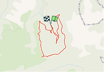

Length
4.8 km

Max alt
723 m

Uphill gradient
141 m
Km-Effort
6.7 km

Min alt
577 m

Downhill gradient
144 m
Boucle
Yes
Creation date :
2020-09-18 08:34:43.652
Updated on :
2020-09-19 08:36:21.747
1h01
Difficulty : Very easy

FREE GPS app for hiking
 SityTrail
IGN / Geographical institutes
SityTrail Plus
The world is yours!
About
Trail Walking of 4.8 km to be discovered at Occitania, Aveyron, Montagnol. This trail is proposed by lablaquiere.
Positioning
Country:
France
Region :
Occitania
Department/Province :
Aveyron
Municipality :
Montagnol
Location:
Unknown
Start:(Dec)
Start:(UTM)
503463 ; 4854998 (31T) N.
Comments