


DENEZIERES_2_24_10_20

drarep
User
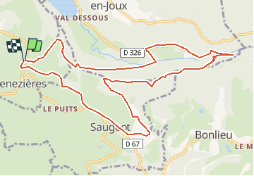

Length
12.5 km

Max alt
761 m

Uphill gradient
420 m
Km-Effort
18.1 km

Min alt
510 m

Downhill gradient
426 m
Boucle
Yes
Creation date :
2020-09-19 09:29:13.141
Updated on :
2020-09-19 09:30:17.406
3h47
Difficulty : Medium

FREE GPS app for hiking
 SityTrail
IGN / Geographical institutes
SityTrail Plus
The world is yours!
About
Trail Walking of 12.5 km to be discovered at Bourgogne-Franche-Comté, Jura, Denezières. This trail is proposed by drarep.
Description
Proosé par Phil


Positioning
Country:
France
Region :
Bourgogne-Franche-Comté
Department/Province :
Jura
Municipality :
Denezières
Location:
Unknown
Start:(Dec)
Start:(UTM)
715052 ; 5165983 (31T) N.
Comments