Trail Walking Muret - muret louge  - Photo
 pidjam
pidjam

User

© OpenStreetMap contributors
Length
Length
6.8 km
Max alt
Max alt
188 m
Uphill gradient
Uphill gradient
35 m
Km-Effort
Km-Effort  
7.3 km
Min alt
Min alt
173 m
Downhill gradient
Downhill gradient
36 m
Boucle
Boucle
Yes
Creation date :
2020-09-20 07:31:05.45
Updated on :
2021-08-24 07:00:10.167

(0 Reviews)

Walking
Walking
6h05
Difficulty : Very easy

Scan this QR Code to open this trail in the SityTrail application

FREE GPS app for hiking

Logo SityTrail SityTrail

IGN / Geographical institutes

Download SityTrail from the App Store Download SityTrail from Google Play

Logo SityTrail SityTrail Plus

The world is yours!

Download SityTrail from the App Store Download SityTrail from Google Play Download SityTrail on Huawei AppGallery

About

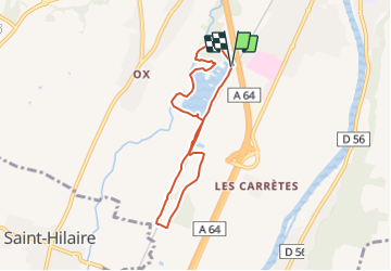
Trail Walking of 6.8 km to be discovered at Occitania, Haute-Garonne, Muret. This trail is proposed by pidjam.

Description

Les chemins au nord menant aux anciennes aires de repos de Rudelle n'existent plus dans la réalité, et si l'on essaie de les suivre ils mènent dans la propriété du château (donc à éviter). Du coup ce tracé est assez court.

Elevation profile

Positioning

Country:
France
Region :
Occitania
Department/Province :
Haute-Garonne
Municipality :
Muret
Location:
Unknown
Start:(UTM)
362996 ; 4811378 (31T) N.


Close
My subscriptions