


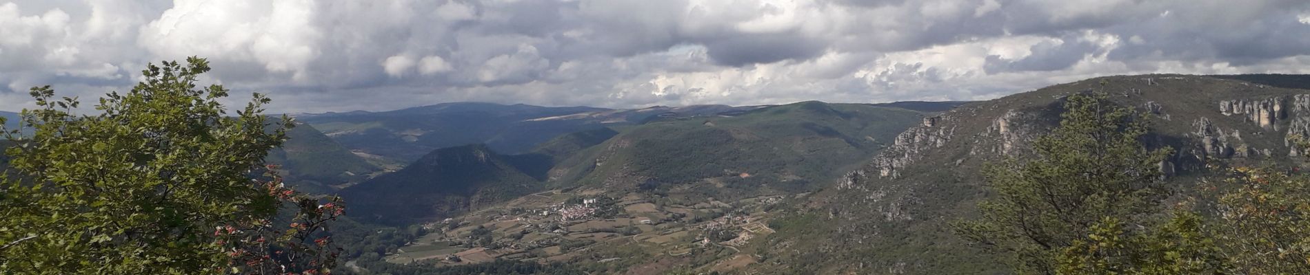
peyreleau et source st martin

CASSISFRAMBOISE
User
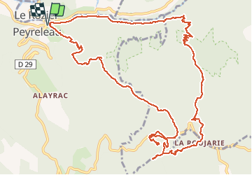

Length
15.9 km

Max alt
903 m

Uphill gradient
675 m
Km-Effort
25 km

Min alt
401 m

Downhill gradient
676 m
Boucle
Yes
Creation date :
2020-09-21 06:41:59.984
Updated on :
2020-09-21 13:18:43.653
4h40
Difficulty : Medium

FREE GPS app for hiking
 SityTrail
IGN / Geographical institutes
SityTrail Plus
The world is yours!
About
Trail Walking of 15.9 km to be discovered at Occitania, Aveyron, Peyreleau. This trail is proposed by CASSISFRAMBOISE.
Photos


Positioning
Country:
France
Region :
Occitania
Department/Province :
Aveyron
Municipality :
Peyreleau
Location:
Unknown
Start:(Dec)
Start:(UTM)
516847 ; 4892912 (31T) N.
Comments