


Le Plateau de Solaure par Aurel

Philindy26
User


5h00
Difficulty : Difficult

FREE GPS app for hiking
 SityTrail
IGN / Geographical institutes
SityTrail Plus
The world is yours!
About
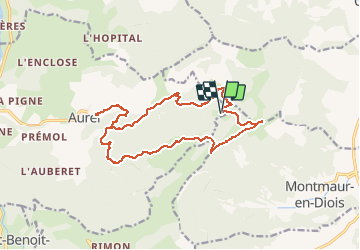
Trail Walking of 17.6 km to be discovered at Auvergne-Rhône-Alpes, Drôme, Aurel. This trail is proposed by Philindy26.
Description
Départ du village de Aurel, à partir du camping...
Géolocalisation (Google Maps) : https://goo.gl/maps/ghuzU5GmboEXroVY6 (44°41'43.9"N / 5°18'12.0"E ou 44.695514, 5.303327).
Prendre la direction du hameau de La Roche et montée par la Peyreire (608 m), le Chambon, Fond Frède, la Combe Tortel et Fondcouverte (1145 m).
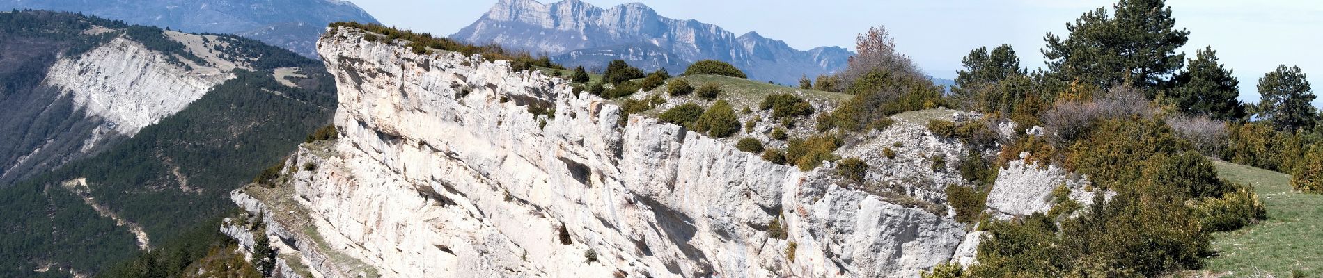
Puis arrivée sur le point culminant du plateau (1262 m).
Retour en suivant les crêtes et descente sur le col du Royer (1140 m) par un sentier aérien où se trouve la grotte du Fournet.
Au col prendre la piste qui passe au Clos, la ferme du Poux (ruine à 964 m) et descente par le bois Diaumenge pour retrouver la piste de montée à la Peyreire.
Photos


Positioning
Comments