Saignon - Apt

LtZIP
User
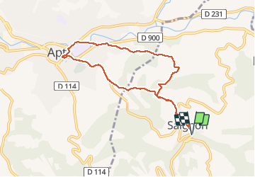

Length
9.3 km

Max alt
494 m

Uphill gradient
289 m
Km-Effort
13.2 km

Min alt
223 m

Downhill gradient
289 m
Boucle
Yes
Creation date :
2020-09-21 09:40:39.933
Updated on :
2021-02-11 07:52:55.018
4h37
Difficulty : Easy

FREE GPS app for hiking
 SityTrail
IGN / Geographical institutes
SityTrail Plus
The world is yours!
About
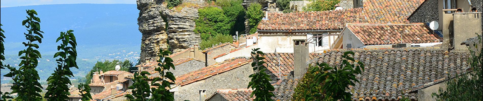
Trail Walking of 9.3 km to be discovered at Provence-Alpes-Côte d'Azur, Vaucluse, Saignon. This trail is proposed by LtZIP.
Description
IBP : Bleu - 39
Circuit sans intérêt car empruntant trop souvent des routes.
Photos


Positioning
Country:
France
Region :
Provence-Alpes-Côte d'Azur
Department/Province :
Vaucluse
Municipality :
Saignon
Location:
Unknown
Start:(Dec)
Start:(UTM)
695278 ; 4859340 (31T) N.
Comments