Trail Walking Bordères-Louron - Borderes-Louron <> Cazeaux - Photo

Borderes-Louron <> Cazeaux

 BIBAR
BIBAR

User

© OpenStreetMap contributors
Length
Length
12.3 km
Max alt
Max alt
1366 m
Uphill gradient
Uphill gradient
662 m
Km-Effort
Km-Effort  
21 km
Min alt
Min alt
784 m
Downhill gradient
Downhill gradient
668 m
Boucle
Boucle
Yes
Creation date :
2020-09-21 11:03:37.925
Updated on :
2020-09-21 18:59:35.274

(0 Reviews)

Walking
Walking
4h09
Difficulty : Medium

Scan this QR Code to open this trail in the SityTrail application

FREE GPS app for hiking

Logo SityTrail SityTrail

IGN / Geographical institutes

Download SityTrail from the App Store Download SityTrail from Google Play

Logo SityTrail SityTrail World

The world is yours!

Download SityTrail from the App Store Download SityTrail from Google Play Download SityTrail on Huawei AppGallery

About

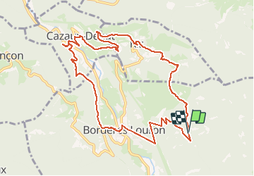
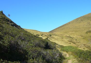
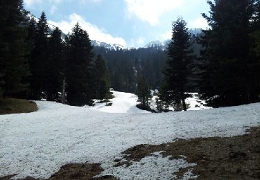
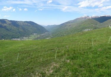
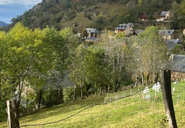
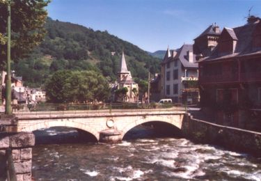
Trail Walking of 12.3 km to be discovered at Occitania, Hautespyrenees, Bordères-Louron. This trail is proposed by BIBAR.

Description

Rando en terrain varié, parfois hors sentier. Le départ se fait près de l’Église de Borderes-Louron.

Elevation profile

Photos

Points of interest

Point of interest Cazaux-Debat - Cimetière annamite - Photo
BIBAR
CAZAUX-DEBAT 

Positioning

Country:
France
Region :
Occitania
Department/Province :
Hautespyrenees
Municipality :
Bordères-Louron
Location:
Unknown
Start:(UTM)
288522 ; 4749808 (31T) N.

Trails nearby

Trail Walking Bourg-d'Oueil - Sommet du Tech et Pic du Lion - Photo
Walking
tracegps

Walking

Difficult
(1)
Bourg-d'Oueil, Occitania, Haute-Garonne, France
7.1 km | 13.3 km-effort
4h 4min
Yes
Trail Walking Cazaux-Fréchet-Anéran-Camors - Boucle de Mont - Photo
Walking
ilur56

Walking

Medium
Cazaux-Fréchet-Anéran-Camors, Occitania, Hautespyrenees, France
13.1 km | 22 km-effort
3h 4min
Yes
Trail On foot Bordères-Louron - Lac de Bareilles et Mont Né - Photo
On foot
PRO

On foot

Easy
Bordères-Louron, Occitania, Hautespyrenees, France
3.8 km | 8.2 km-effort
1h 51min
No
Trail Walking Cazaux-Fréchet-Anéran-Camors - Cazeaux Frechet - Mont-Cazeaux Frechet - Photo
Walking
Forsans

Walking

Easy
Cazaux-Fréchet-Anéran-Camors, Occitania, Hautespyrenees, France
8.4 km | 12.4 km-effort
2h 34min
Yes
Trail Walking Bareilles - Lac de Bareilles - Photo
Walking
GUIDE
lhomme.ph

Walking

Medium
Bareilles, Occitania, Hautespyrenees, France
13.4 km | 24 km-effort
7h 15min
Yes
Trail Walking Cazaux-Fréchet-Anéran-Camors - Rando patrimoine en Vallée du Louron - Photo
Walking
tracegps

Walking

Medium
Cazaux-Fréchet-Anéran-Camors, Occitania, Hautespyrenees, France
8.3 km | 12 km-effort
5h 0min
No
Trail Walking Cazaux-Fréchet-Anéran-Camors - Sentier des estimes - Photo
Walking
papounet32

Walking

Very difficult
Cazaux-Fréchet-Anéran-Camors, Occitania, Hautespyrenees, France
14.7 km | 25 km-effort
4h 18min
Yes
Trail On foot Arreau - ARREAU Frechet-Aure Arreau en passant par le calvaire G3
On foot
GUIDE
marmotte65

On foot

Easy
Arreau, Occitania, Hautespyrenees, France
8.3 km | 11.5 km-effort
Unknown
Yes
Trail Mountain bike Arreau - En forêt de Bareilles - Photo
Mountain bike
tracegps

Mountain bike

Medium
Arreau, Occitania, Hautespyrenees, France
32 km | 48 km-effort
2h 30min
Yes


Close
My subscriptions