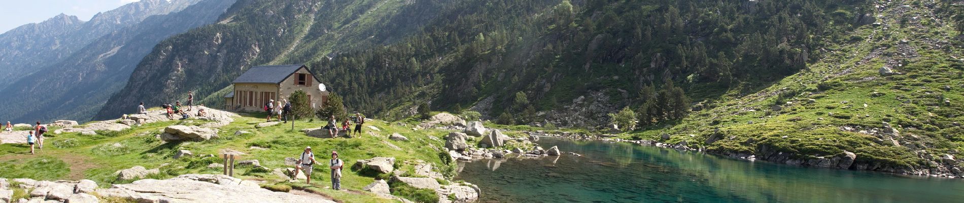
Trail Walking Cauterets - Lac d'Estom - Photo
© OpenStreetMap contributors
Length
Length
11.4 km
Max alt
Max alt
1820 m
Uphill gradient
Uphill gradient
455 m
Km-Effort
Km-Effort  
17.5 km
Min alt
Min alt
1369 m
Downhill gradient
Downhill gradient
454 m
Boucle
Boucle
Yes
Creation date :
2020-09-22 18:26:08.861
Updated on :
2020-09-23 07:09:18.427

(1 Reviews)

Walking
Walking
3h30
Difficulty : Medium

Scan this QR Code to open this trail in the SityTrail application

FREE GPS app for hiking

Logo SityTrail SityTrail

IGN / Geographical institutes

Download SityTrail from the App Store Download SityTrail from Google Play

Logo SityTrail SityTrail Plus

The world is yours!

Download SityTrail from the App Store Download SityTrail from Google Play Download SityTrail on Huawei AppGallery

About

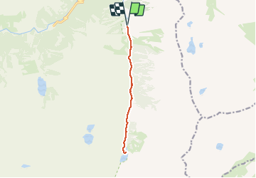
Trail Walking of 11.4 km to be discovered at Occitania, Hautespyrenees, Cauterets. This trail is proposed by Philindy26.

Description

Départ de l'Hôtel-Restaurant "La Fruitière", 65110 Cauterets - Pyrénées,
Géolocalisation du départ (Google Maps) : https://goo.gl/maps/Udb4JipWcbMnFNXUA (42°51'11.9"N / 0°05'53.1"W ou 42.853291, -0.098070).

Aller-retour au lac d’Estom en suivant le gave de Lutour.

Elevation profile

Photos

22 photos in total. Please click on a photo to see them all in the gallery.

Positioning

Country:
France
Region :
Occitania
Department/Province :
Hautespyrenees
Municipality :
Cauterets
Location:
Unknown
Start:(UTM)
737098 ; 4748624 (30T) N.

Comments

Please log in to post a review or rate the element


Merci pour ces belles photos !


Close
My subscriptions