


20200923 rando RF

Sugg
User
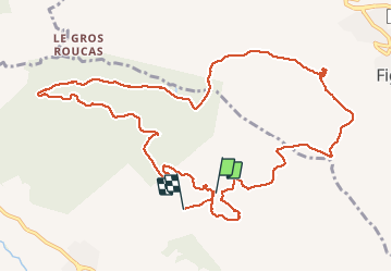

Length
14.9 km

Max alt
549 m

Uphill gradient
374 m
Km-Effort
20 km

Min alt
399 m

Downhill gradient
407 m
Boucle
No
Creation date :
2020-09-23 06:54:06.12
Updated on :
2020-09-23 14:00:21.309
5h38
Difficulty : Medium

FREE GPS app for hiking
 SityTrail
IGN / Geographical institutes
SityTrail Plus
The world is yours!
About
Trail Walking of 14.9 km to be discovered at Provence-Alpes-Côte d'Azur, Var, Draguignan. This trail is proposed by Sugg.
Description
Malmont Ouest la cassade Bois Panisse et nouveau parcours sud.
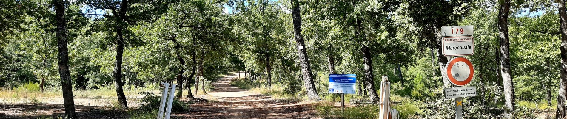
Photos


Positioning
Country:
France
Region :
Provence-Alpes-Côte d'Azur
Department/Province :
Var
Municipality :
Draguignan
Location:
Unknown
Start:(Dec)
Start:(UTM)
295336 ; 4825783 (32T) N.
Comments