


Tour du Penchinier

pb07
User

Length
5.1 km

Max alt
631 m

Uphill gradient
165 m
Km-Effort
7.3 km

Min alt
470 m

Downhill gradient
164 m
Boucle
Yes
Creation date :
2020-09-24 12:23:26.219
Updated on :
2020-09-24 14:58:46.806
1h36
Difficulty : Very easy

FREE GPS app for hiking
 SityTrail
IGN / Geographical institutes
SityTrail Plus
The world is yours!
About
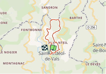
Trail Walking of 5.1 km to be discovered at Auvergne-Rhône-Alpes, Ardèche, Saint-Andéol-de-Vals. This trail is proposed by pb07.
Positioning
Country:
France
Region :
Auvergne-Rhône-Alpes
Department/Province :
Ardèche
Municipality :
Saint-Andéol-de-Vals
Location:
Unknown
Start:(Dec)
Start:(UTM)
610950 ; 4949749 (31T) N.
Comments