


bonnieux2

Alain Derrives
User
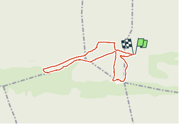

Length
7.9 km

Max alt
723 m

Uphill gradient
184 m
Km-Effort
10.3 km

Min alt
629 m

Downhill gradient
183 m
Boucle
Yes
Creation date :
2020-09-24 12:16:59.604
Updated on :
2020-09-24 18:58:00.691
1h47
Difficulty : Very easy

FREE GPS app for hiking
 SityTrail
IGN / Geographical institutes
SityTrail Plus
The world is yours!
About
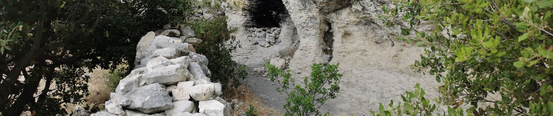
Trail Walking of 7.9 km to be discovered at Provence-Alpes-Côte d'Azur, Vaucluse, Bonnieux. This trail is proposed by Alain Derrives.
Photos


Positioning
Country:
France
Region :
Provence-Alpes-Côte d'Azur
Department/Province :
Vaucluse
Municipality :
Bonnieux
Location:
Unknown
Start:(Dec)
Start:(UTM)
682934 ; 4852200 (31T) N.
Comments