


Le Val Rebours

JMCMoreau
User
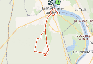

Length
13.1 km

Max alt
92 m

Uphill gradient
156 m
Km-Effort
15.1 km

Min alt
0 m

Downhill gradient
156 m
Boucle
Yes
Creation date :
2020-09-25 15:45:33.437
Updated on :
2020-09-25 15:49:15.678
3h20
Difficulty : Easy

FREE GPS app for hiking
 SityTrail
IGN / Geographical institutes
SityTrail Plus
The world is yours!
About
Trail Walking of 13.1 km to be discovered at Normandy, Seine-Maritime, Arelaune-en-Seine. This trail is proposed by JMCMoreau.
Description
Marche sur la 1/2 journée, sans grande difficulté.
Positioning
Country:
France
Region :
Normandy
Department/Province :
Seine-Maritime
Municipality :
Arelaune-en-Seine
Location:
Unknown
Start:(Dec)
Start:(UTM)
338766 ; 5483567 (31U) N.
Comments