


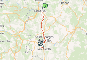
La canourgues à les Vignes

marie-didi
User

Length
26 km

Max alt
942 m

Uphill gradient
769 m
Km-Effort
37 km

Min alt
418 m

Downhill gradient
913 m
Boucle
No
Creation date :
2020-09-27 06:00:56.531
Updated on :
2020-09-27 13:50:24.692
7h17
Difficulty : Medium

FREE GPS app for hiking
 SityTrail
IGN / Geographical institutes
SityTrail Plus
The world is yours!
About
Trail Walking of 26 km to be discovered at Occitania, Lozère, La Canourgue. This trail is proposed by marie-didi.
Positioning
Country:
France
Region :
Occitania
Department/Province :
Lozère
Municipality :
La Canourgue
Location:
La Canourgue
Start:(Dec)
Start:(UTM)
517070 ; 4919911 (31T) N.
Comments