


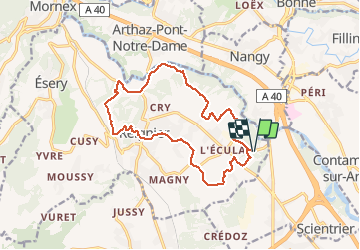
Tour de Reignier depuis l'Eculaz

Kargil
User GUIDE

Length
15 km

Max alt
496 m

Uphill gradient
221 m
Km-Effort
17.9 km

Min alt
414 m

Downhill gradient
220 m
Boucle
Yes
Creation date :
2020-09-27 11:17:46.481
Updated on :
2020-12-22 07:57:59.531
3h11
Difficulty : Easy

FREE GPS app for hiking
 SityTrail
IGN / Geographical institutes
SityTrail Plus
The world is yours!
About
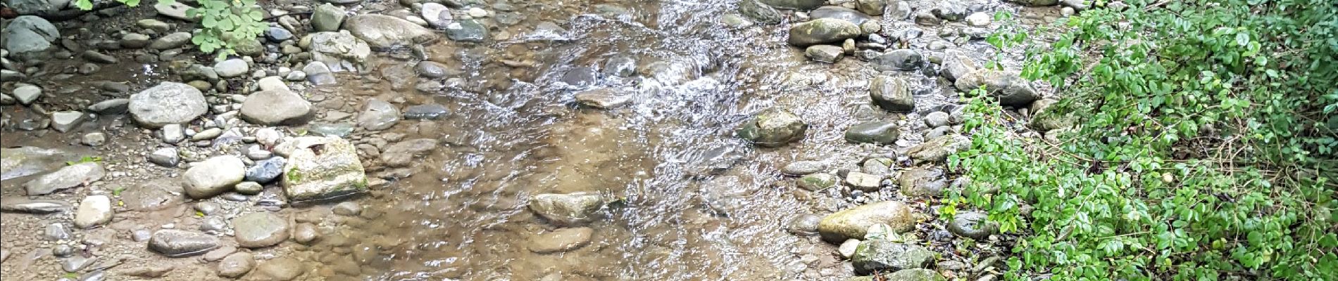
Trail Walking of 15 km to be discovered at Auvergne-Rhône-Alpes, Upper Savoy, Reignier-Ésery. This trail is proposed by Kargil.
Photos

Positioning
Country:
France
Region :
Auvergne-Rhône-Alpes
Department/Province :
Upper Savoy
Municipality :
Reignier-Ésery
Location:
Reignier
Start:(Dec)
Start:(UTM)
291972 ; 5112186 (32T) N.
Comments