


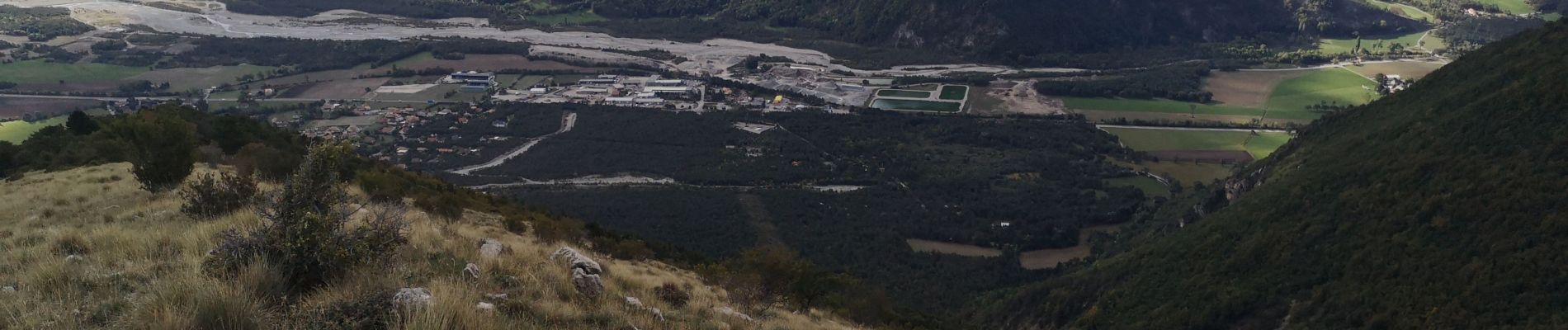
Pic Chauve/Roche des Arnauds /28/09/20.

Dervalmarc
User
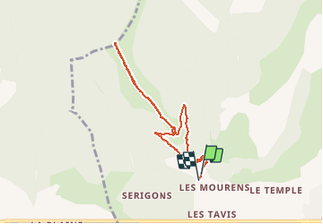

Length
7.8 km

Max alt
1744 m

Uphill gradient
805 m
Km-Effort
18.6 km

Min alt
953 m

Downhill gradient
813 m
Boucle
Yes
Creation date :
2020-09-28 05:38:04.633
Updated on :
2020-09-28 10:03:18.353
2h48
Difficulty : Medium

FREE GPS app for hiking
 SityTrail
IGN / Geographical institutes
SityTrail Plus
The world is yours!
About
Trail Walking of 7.8 km to be discovered at Provence-Alpes-Côte d'Azur, Hautes-Alpes, La Roche-des-Arnauds. This trail is proposed by Dervalmarc.
Description
Très beaux parcours de crête. Belvédère sur le Pic et cirque de Bure.
Photos


Positioning
Country:
France
Region :
Provence-Alpes-Côte d'Azur
Department/Province :
Hautes-Alpes
Municipality :
La Roche-des-Arnauds
Location:
Unknown
Start:(Dec)
Start:(UTM)
732551 ; 4939169 (31T) N.
Comments