


La Grave J8

Airelle
User
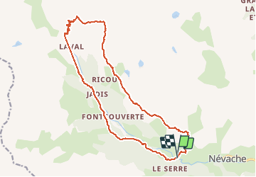

Length
19.8 km

Max alt
2412 m

Uphill gradient
869 m
Km-Effort
31 km

Min alt
1744 m

Downhill gradient
868 m
Boucle
Yes
Creation date :
2020-09-29 08:46:56.0
Updated on :
2020-09-29 17:46:49.754
5h55
Difficulty : Difficult

FREE GPS app for hiking
 SityTrail
IGN / Geographical institutes
SityTrail Plus
The world is yours!
About
Trail Walking of 19.8 km to be discovered at Provence-Alpes-Côte d'Azur, Hautes-Alpes, Névache. This trail is proposed by Airelle.
Description
Vallée de la Claree
Positioning
Country:
France
Region :
Provence-Alpes-Côte d'Azur
Department/Province :
Hautes-Alpes
Municipality :
Névache
Location:
Unknown
Start:(Dec)
Start:(UTM)
309295 ; 4987934 (32T) N.
Comments