


Presle

terpant
User

Length
9 km

Max alt
1002 m

Uphill gradient
361 m
Km-Effort
13.8 km

Min alt
748 m

Downhill gradient
363 m
Boucle
Yes
Creation date :
2020-09-30 07:23:44.0
Updated on :
2020-09-30 13:01:43.116
4h37
Difficulty : Unknown

FREE GPS app for hiking
 SityTrail
IGN / Geographical institutes
SityTrail Plus
The world is yours!
About
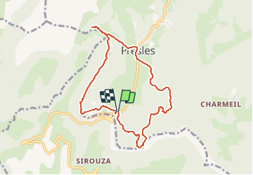
Trail Walking of 9 km to be discovered at Auvergne-Rhône-Alpes, Isère, Presles. This trail is proposed by terpant.
Description
Chorenche
Positioning
Country:
France
Region :
Auvergne-Rhône-Alpes
Department/Province :
Isère
Municipality :
Presles
Location:
Unknown
Start:(Dec)
Start:(UTM)
687147 ; 4994645 (31T) N.
Comments