


Garonne bouconne

ra2000
User
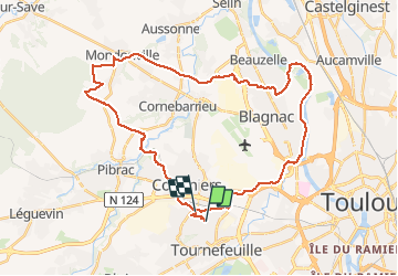

Length
41 km

Max alt
193 m

Uphill gradient
349 m
Km-Effort
46 km

Min alt
119 m

Downhill gradient
346 m
Boucle
No
Creation date :
2020-09-30 11:36:38.722
Updated on :
2020-09-30 16:21:17.301
3h49
Difficulty : Medium

FREE GPS app for hiking
 SityTrail
IGN / Geographical institutes
SityTrail Plus
The world is yours!
About
Trail Mountain bike of 41 km to be discovered at Occitania, Haute-Garonne, Colomiers. This trail is proposed by ra2000.
Positioning
Country:
France
Region :
Occitania
Department/Province :
Haute-Garonne
Municipality :
Colomiers
Location:
Unknown
Start:(Dec)
Start:(UTM)
366067 ; 4828286 (31T) N.
Comments