


chalais

Liebeaux
User

Length
17.2 km

Max alt
1078 m

Uphill gradient
1118 m
Km-Effort
31 km

Min alt
225 m

Downhill gradient
842 m
Boucle
No
Creation date :
2020-10-01 06:50:46.795
Updated on :
2020-10-01 13:24:54.342
6h30
Difficulty : Very easy

FREE GPS app for hiking
 SityTrail
IGN / Geographical institutes
SityTrail Plus
The world is yours!
About
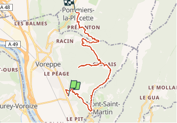
Trail Walking of 17.2 km to be discovered at Auvergne-Rhône-Alpes, Isère, Voreppe. This trail is proposed by Liebeaux.
Positioning
Country:
France
Region :
Auvergne-Rhône-Alpes
Department/Province :
Isère
Municipality :
Voreppe
Location:
Unknown
Start:(Dec)
Start:(UTM)
707869 ; 5017151 (31T) N.
Comments