


Saint baume-version courte

Chapatann
User
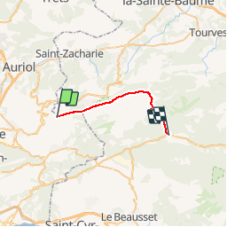

Length
21 km

Max alt
1143 m

Uphill gradient
496 m
Km-Effort
30 km

Min alt
349 m

Downhill gradient
1164 m
Boucle
No
Creation date :
2014-12-10 00:00:00.0
Updated on :
2014-12-10 00:00:00.0
5h00
Difficulty : Medium

FREE GPS app for hiking
 SityTrail
IGN / Geographical institutes
SityTrail Plus
The world is yours!
About
Trail Walking of 21 km to be discovered at Provence-Alpes-Côte d'Azur, Bouches-du-Rhône, Gémenos. This trail is proposed by Chapatann.
Positioning
Country:
France
Region :
Provence-Alpes-Côte d'Azur
Department/Province :
Bouches-du-Rhône
Municipality :
Gémenos
Location:
Unknown
Start:(Dec)
Start:(UTM)
718073 ; 4798912 (31T) N.
Comments