


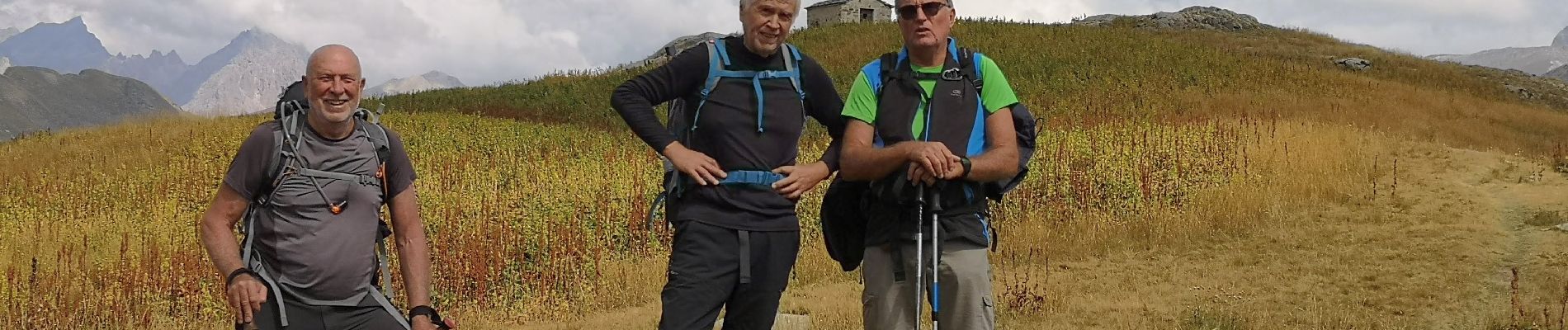
bauvezer_villars j1: lacs du Lauzanier

bernir
User
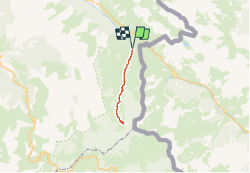

Length
13.9 km

Max alt
2449 m

Uphill gradient
588 m
Km-Effort
22 km

Min alt
1904 m

Downhill gradient
589 m
Boucle
Yes
Creation date :
2020-10-02 11:42:09.964
Updated on :
2020-10-10 07:26:20.387
4h29
Difficulty : Medium

FREE GPS app for hiking
 SityTrail
IGN / Geographical institutes
SityTrail Plus
The world is yours!
About
Trail Walking of 13.9 km to be discovered at Provence-Alpes-Côte d'Azur, Alpes-de-Haute-Provence, Val-d'Oronaye. This trail is proposed by bernir.
Photos


Positioning
Country:
France
Region :
Provence-Alpes-Côte d'Azur
Department/Province :
Alpes-de-Haute-Provence
Municipality :
Val-d'Oronaye
Location:
Larche
Start:(Dec)
Start:(UTM)
331643 ; 4920508 (32T) N.
Comments