


ROCHE DES BRUYERES

surceneux
User
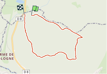

Length
3.9 km

Max alt
975 m

Uphill gradient
154 m
Km-Effort
6 km

Min alt
804 m

Downhill gradient
172 m
Boucle
Yes
Creation date :
2020-10-03 12:56:38.357
Updated on :
2020-10-03 14:59:42.348
1h00
Difficulty : Very easy

FREE GPS app for hiking
 SityTrail
IGN / Geographical institutes
SityTrail Plus
The world is yours!
About
Trail Walking of 3.9 km to be discovered at Grand Est, Vosges, Xonrupt-Longemer. This trail is proposed by surceneux.
Description
MARTIMPRE COL RF FONTAINE GILET
RF ROCHE DES BRUYÈRES MARTIMPRE
Positioning
Country:
France
Region :
Grand Est
Department/Province :
Vosges
Municipality :
Xonrupt-Longemer
Location:
Unknown
Start:(Dec)
Start:(UTM)
344176 ; 5329300 (32U) N.
Comments