


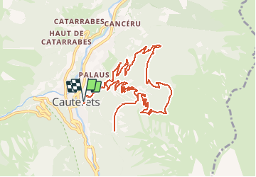
Plateau du Lisey

Philindy26
User


5h00
Difficulty : Difficult

FREE GPS app for hiking
 SityTrail
IGN / Geographical institutes
SityTrail Plus
The world is yours!
About
Trail Walking of 13 km to be discovered at Occitania, Hautespyrenees, Cauterets. This trail is proposed by Philindy26.
Description
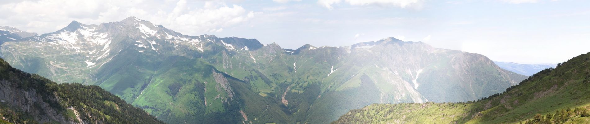
Départ de Cauterets, Pyrénées...
Géolocalisation (Google Maps) : https://goo.gl/maps/d4Z2qnipJU8gxnaq7 (42°53'23.2"N / 0°06'45.0"W ou 42.889770, -0.112494).
Montée au plateau du Lisey par les établissements thermales de Pauze et les 21 lacets à partir de la cabane du Bousquet…
En montant, vous pouvez vous rendre au belvédère du Turon des Oules (1380 m) pour 2 Km aller-retour...
Au plateau, retour par le chalet de la Reine Hortense et Mey Mount (1131 m).
A la montée, vous trouverez un superbe sentier ombragé avec ses 21 lacets...
C'est un magnifique travail avec ces murs en pierres sèches…
Photos


23 photos in total. Please click on a photo to see them all in the gallery.
Positioning
Comments