


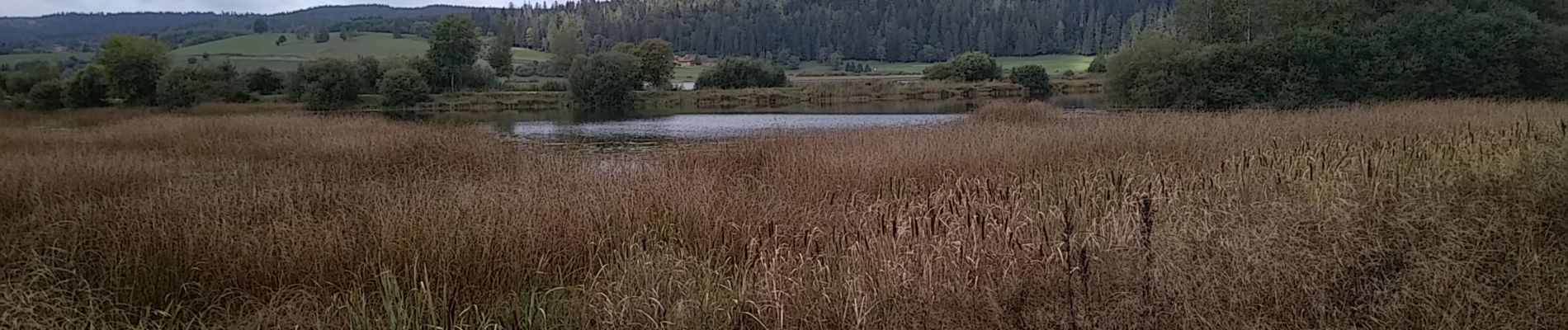
Lac de Remoray

helmut68
User


3h25
Difficulty : Easy

FREE GPS app for hiking
 SityTrail
IGN / Geographical institutes
SityTrail Plus
The world is yours!
About
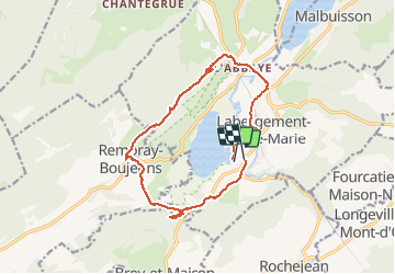
Trail Walking of 14.5 km to be discovered at Bourgogne-Franche-Comté, Doubs, Labergement-Sainte-Marie. This trail is proposed by helmut68.
Description
Le lac de Remoray occupe le fond d'une large vallée glaciaire. Autrefois relié au lac de Saint Point , il en a été séparé par le cône alluvial crée par le Doubs au débouché des gorges du Fourperet.
Le lac , ses marais , ses roselières, la source des Capucins , les vestiges de l'Abbaye cistercienne du Mont Sainte- Marie , la forêt profonde et majestueuse du Massif de la Grande Côte, jalonnent cette promenade enrichissante . Le belvédère des deux lacs vous offre un point de vue unique sur la large vallée glaciaire et ses deux lacs .
Balisage : " jaune bleu "
Alors à vos chaussures !
Photos


Positioning
Comments