


12132319-ravin des Arcs

ARVIEU
User

Length
15.5 km

Max alt
329 m

Uphill gradient
470 m
Km-Effort
22 km

Min alt
108 m

Downhill gradient
471 m
Boucle
Yes
Creation date :
2020-10-07 12:28:55.815
Updated on :
2020-10-07 12:30:35.676
4h34
Difficulty : Very difficult

FREE GPS app for hiking
 SityTrail
IGN / Geographical institutes
SityTrail Plus
The world is yours!
About
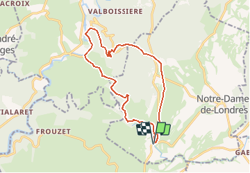
Trail Walking of 15.5 km to be discovered at Occitania, Hérault, Notre-Dame-de-Londres. This trail is proposed by ARVIEU.
Positioning
Country:
France
Region :
Occitania
Department/Province :
Hérault
Municipality :
Notre-Dame-de-Londres
Location:
Unknown
Start:(Dec)
Start:(UTM)
559699 ; 4851231 (31T) N.
Comments