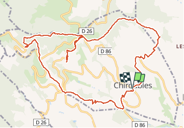
Chiroubles (14 km - D. 555 m)

Thomasdanielle
User

Length
13.9 km

Max alt
741 m

Uphill gradient
555 m
Km-Effort
21 km

Min alt
310 m

Downhill gradient
555 m
Boucle
Yes
Creation date :
2020-10-08 07:42:56.0
Updated on :
2020-10-09 16:50:00.187
5h18
Difficulty : Easy

FREE GPS app for hiking
 SityTrail
IGN / Geographical institutes
SityTrail Plus
The world is yours!
About
Trail Walking of 13.9 km to be discovered at Auvergne-Rhône-Alpes, Rhône, Chiroubles. This trail is proposed by Thomasdanielle.
Description
D/A Parking de la poste (Attention peu de place)
Très belle randonnée, très variée
Positioning
Country:
France
Region :
Auvergne-Rhône-Alpes
Department/Province :
Rhône
Municipality :
Chiroubles
Location:
Unknown
Start:(Dec)
Start:(UTM)
628499 ; 5115421 (31T) N.
Comments